September 3, 2020 · Leandro Scheurle
In the history of mountaineering, as in life, there have always been stages of striving with respect to achievements, goals and difficulties. Who is the biggest, the longest, the hardest, and of course, the highest!
The whims of geology, among other things tied to the subduction of the oceanic plate beneath the continental one, have given the Andes mountain range the gift of a generally greater elevation across the South American sector. That's why, from Ecuador down to central Argentina and Chile, there are many mountains that exceed 5000 meters, something that doesn't happen in the classic European ranges — say the Alps, where the maximum height is 4850 masl at the summit of Mont Blanc, between France and Switzerland.
As a matter of pure numbers, the mountaineering world has grouped together and made famous the world's highest mountains, those exceeding 8000 m above sea level, of which there are 14, spread across Nepal, China and Pakistan, mostly rising out of the magnificent Himalaya and Karakoram ranges. As a result, those that fell just short of reaching that modest figure, like Gyachung Kang (7952) or Gasherbrum III (7946), which are less than 80 meters shy of the lowest of the 8000ers, Shishapangma (8027), never earned the fame that might arguably have been their due.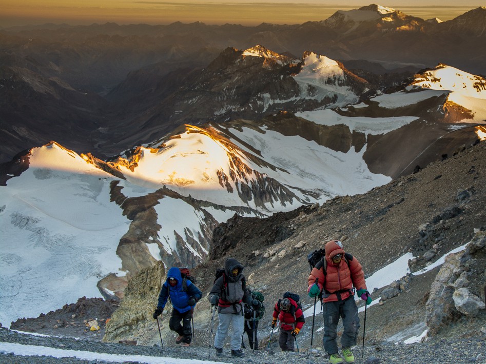 A similar fate could easily have befallen Aconcagua, which, at 6962 masl and brushing up against 7000 m, could just as easily have suffered the same fate as the "almost-8000ers" and belonged to the group of "loser" or "forgotten" mountains in some hypothetical ranking of the Americas' 14 seven-thousanders. But luckily for the Stone Sentinel, its colossal height was enough to make it the highest peak on the entire American continent, in the southern hemisphere, and in the western hemisphere too, letting it stick its tongue out at all the mountaineering historians who lay in wait to belittle it.
In much the same way, in the Americas in recent years there's also emerged a grouping of mountains exceeding 6500 masl, which, as it happens, also number 14 (if El Muerto is included, whose exact measurements are still unconfirmed). To this day it hasn't been confirmed that anyone has managed to summit all 14 peaks, due to the extreme difficulty of Yerupajá, one of the two +6500ers found in Peru, which to date has seen only a handful of ascents, many years ago now, to its main summit. Since Yerupajá happens to rank 11th, and since we're at it — since the "perfect" number we've always been taught to use for dividing big groups is 10 — today there's also this new, marketing-friendly project: The 10 Highest Mountains in the Americas, or Andes Top 10.
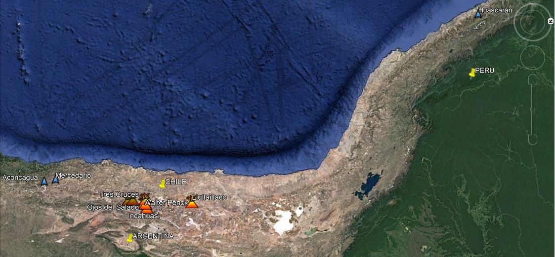
Most of the top 10 are clustered in a high stretch of the Puna, in the province of Catamarca (Atacama in Chile): 5 lie within Argentine territory, 4 share their summit between Argentina and Chile, and one is located in Peru.
Finally, it's worth mentioning that this sudden interest in the American giants over 6500 m has also been used to define other groupings and projects, such as the Argentina - Chile +6500 (which goes beyond the border and also includes mountains found only in Argentina, since they belong to the same range), the Argentina Top 10 (Argentina's 10 highest), the Volcanic World Top (the world's highest volcanoes), the Estrella Diaguita (the 7 of these mountains located in the Puna de Atacama) and the Winter 6500ers.
10 - Incahuasi - 6638 masl 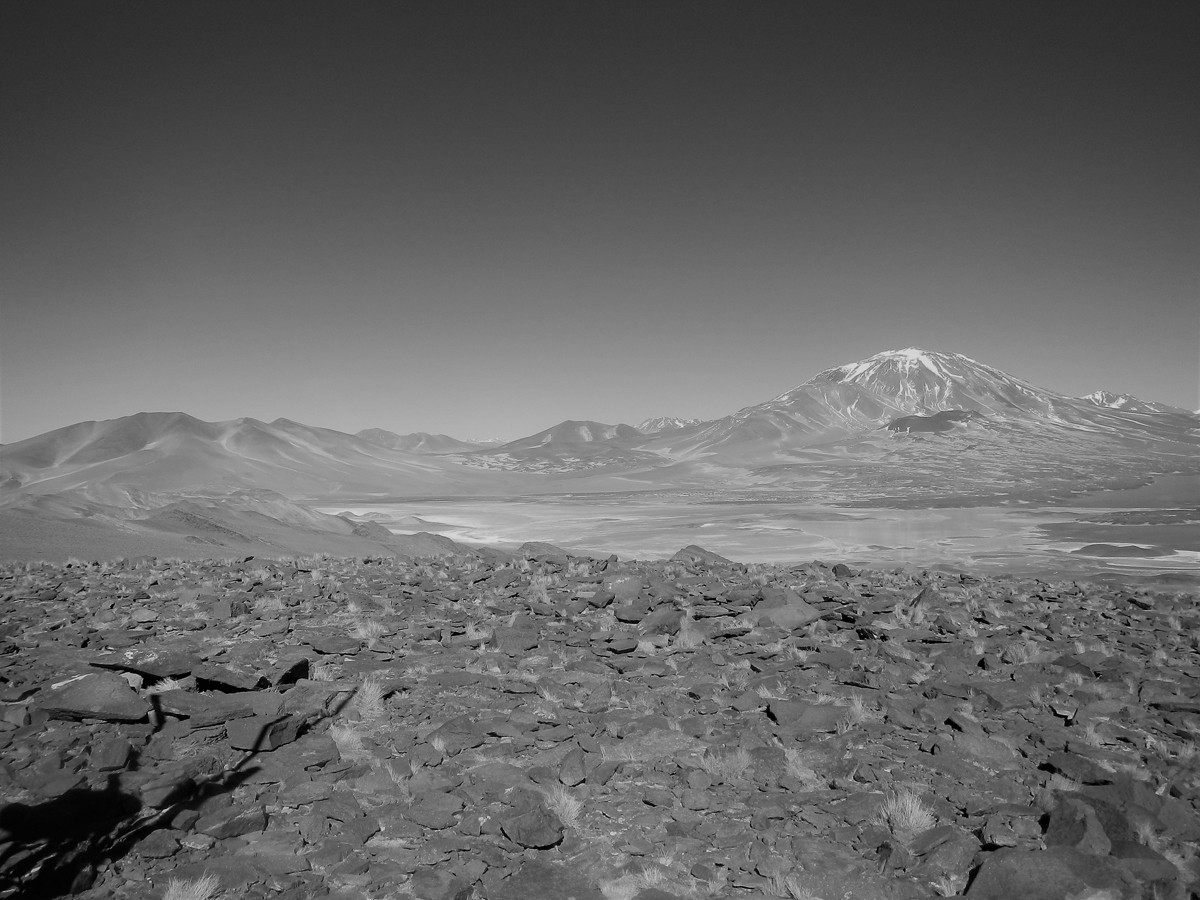
- Location: Catamarca (Argentina) and Atacama (Chile)
- Town and main access: Fiambalá, Route 60, Paso San Francisco.
- Best ascent season: October to March
- Summit GPS: 27°02´03¨ S - 68° 17´ 45¨W
- Organized expedition program: Click
Incahuasi is one of the highest volcanoes in the world and perhaps the most accessible of them all, since it can be reached via a route from Argentina and from Las Grutas, right next to Paso San Francisco. Long before any modern attempts to climb it, the Incas reached the summit of Incahuasi more than 500 years ago and left behind a ceremonial shrine there that, together with the one on Llullaillaco, represents one of the highest sanctuaries and archaeological sites in the world. It was the first of the Atacama volcano giants to be climbed in a sporting sense, in 1913.
Topographic Description: Incahuasi is a cone-shaped volcano with several much smaller peaks attached to it, which don't manage to take away from its typical silhouette. Seen from the south, it has a curious bell-like shape.
Its main body is crowned by a large extinct crater, above which rise the Main or North Summit (6,638 m) and the South Summit (6,562 m). Closing off the crater to the SW of the Main summit is a peak that reaches 6,541 m and could be considered a secondary summit. Attached to its east face is the eye-catching secondary summit known as Inca Chico (5,861 m). At the foot of its NE face, a cluster of small, dark, reddish scoria cones, fused together and known as the Gemelos (Twins) volcanitos, rises only slightly (5,106 m). The mountain has no glaciers, but the central depression of its vast summit plateau is covered in permanent snow. The Eastern snowfield descends from there directly toward the saddle with Inca Chico, while the smaller Northeastern and Southwestern snowfields are sheltered by rocky ridges high up on those slopes.
9 - Walter Penck - 6658 masl 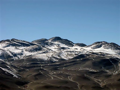
- Location: Catamarca (Argentina)
- Town and main access: Fiambalá, Route 60, Paso San Francisco.
- Best ascent season: October to March
- Summit GPS: 27°11´46¨ S - 68° 33´ 38¨W
Walter Penck, also known on maps as Cazadero, is the least-known of the +6500ers, since it's always been overshadowed by its immense neighbors, such as Ojos del Salado. With a fairly flattened, rounded, and unconventional shape compared to the classic rugged-mountain profile, it's a volcano that's drawn very little attention until now, when fate has included it in several projects, such as those covering the Americas' highest peaks, Argentina's highest peaks, and the world's highest volcanoes.
Topographic Description: Its main body is crowned by three rounded summits aligned N to S. The central one is the Main Summit (6,658 m), and at its top rise three mounds that appear to be roughly the same height. The middle one is the tallest and has a stone cairn and a summit log. The secondary peaks are the South Summit (6,555 m), sometimes called Falso Walter Penck, and the North Summit (6,558 m). To the NW rises Pico ATA or Arianos (6,497 m), separated from Walter Penck by a saddle reaching 6,310 m. To the SE stands out the perfectly conical silhouette of Pico Olmedo (6,241 m), also called Santiago or Volcán del Viento, separated by a high saddle of 5,975 m. A veritable court of satellite peaks surrounds the main body. Farther to the west lies the smaller, less integrated Punta Oeste (5,970 m).
8 - Mercedario - 6720 masl 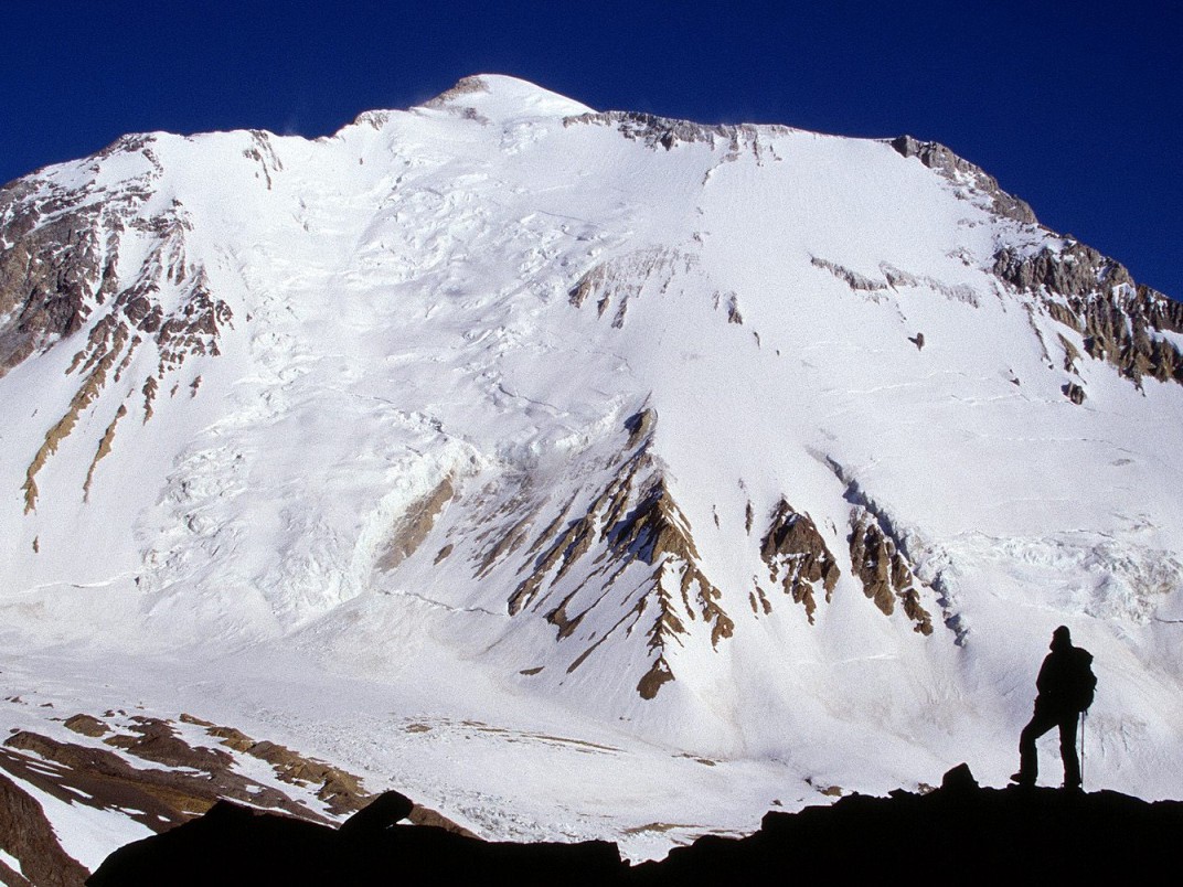
- Location: San Juan (Argentina)
- Town and main access: Barreal, Valle de Calingasta, Valle Río Los Patos.
- Best ascent season: December to March
- Summit GPS: 31°58´46¨ S - 70° 06´ 47¨W
- Organized expedition program: Click
Mercedario belongs to the Altos Andes zone, just 100 km north of Aconcagua, and is one of the +6500ers that still retains glaciers on its slopes. Like the Colossus of the Americas, it doesn't border Chile, and belongs to the Cordón de La Ramada, a massif of great mountains above 6000 m, such as the peaks of the same name, La Mesa, Alma Negra and Pico Polaco. It was first summited on the famous Polish expedition of 1934 (chronicled in the book "Higher than the Condors"), whose members also summited the peaks of the aforementioned range and later made the first ascent of Aconcagua's northeast route, known ever since as the Glaciar de los Polacos (Poles' Glacier). It's the highest point in San Juan Province.
Topographic Description: Mercedario is a mountain of tectonic origin, characterized by a prominent main body, beneath which numerous small, intricate ravines wind their way down. These give rise to several irregular ridges dotted with intermediate points, generally too minor to be individually identified. The massif is bounded by Paso Ancho to the east, which separates it from Cerro Wanda, and the Collado del Peine to the south, which separates it from Pico Polaco. All its other faces drop into river valleys, forming a vast basin fed by its snows. The most notable is the Río Colorado, which originates from the great cirque formed by Mercedario's south face and the peaks Polaco, La Mesa and La Ramada. To the SW rises the Río Mercedario, to the NW the Arroyo del Bramadero, and to the NE those of Las Pichireguas and Laguna Blanca. Eventually, after several confluences, all these streams flow into the Río de los Patos. Its main body is monolithic, with vast faces separated by well-defined ridges. The East face is largely occupied by the Caballito glacier. This one, with a 50° incline, climbs up to 6,000 m, where it merges into the summit plateau, which gently rises along the foot of the summit ridge to the W and NW, up to the summit. The famous South face is a formidable slope of between 40 and 65° and nearly 2,000 m in height. Fully covered in ice and snow, it has two crevassed glaciers at its W and E ends. The first is known as Ostrowski, and the other, smaller one, as Karpinski. The West face is a near-vertical wall, mostly rock, with the small Northwest Glacier occupying a depression in its N section. The Northeast face, finally, is gentle and free of permanent snow. The sole exception is the retreating Hoyada glacier, which occupies its highest section. As for its height, Argentina's IGN lists it at 6,770 meters, but according to information provided by SRTM with the corresponding corrections, it actually reaches 6,701 m. The original SRTM data indicates 6,697 m, and it's worth noting that many sources list 6,720 meters.
7 - Llullaillaco - 6739 masl 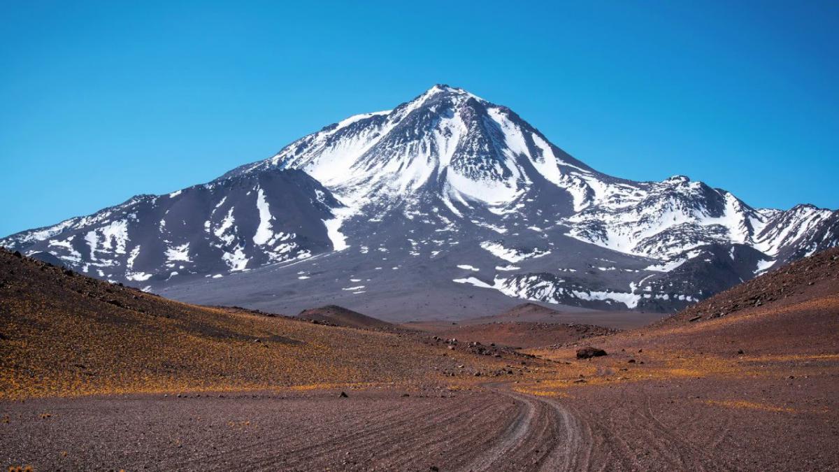
- Location: Salta (Argentina) and Antofagasta (Chile)
- Town and main access: Tolar Grande, Mina La Casualidad (from Argentina); Antofagasta or Atacama and Monturaqui (Chile)
- Best ascent season: October to May
- Summit GPS: 24°43´12¨ S - 68° 32´ 12¨W
- Organized expedition program: Click
Llulla is THE sacred mountain of the Incas. In 1999, an archaeological expedition found, very close to the summit, two Inca mummies that today remain preserved at the High Mountain Museum in the city of Salta. The mysticism surrounding its slopes surrounds every mountaineer who approaches it. There are routes both from Argentina and from Chile. If attempted from Argentina, it's important to request a permit from the Salta anthropology museum, since the mountain has been declared an Archaeological Sanctuary. In Chile, the mountain is included within Llullaillaco National Park. Meaning of the Name: The most common interpretation comes from combining the Quechua words llulla (lie, deceptive or false thing) and yaku (water), meaning “lying water” or “watering hole of deceit” (cf. González Hoguin's Quechua Dictionary, 1608). It's the highest point in Salta Province.
Topographic Description: Llullaillaco is a cone-shaped volcano with a shoulder to the west forming a vast plateau. The massif is bordered by the Llullaillaco N and S saddles, to the NE and SW. The first separates it from Volcán Inca and its satellite peak Zorra Vieja, and the second from Volcán Dos Naciones and its satellite peak Silla. To the east, its slopes sink into a sandy plain that separates it from Volcán Rosado, while to the west another sandy plain gently descends toward the Salar de Punta Negra, crossed by the Llullaillaco stream and other even smaller trickles of water. To the northwest lies the NW summit, which reaches 6,561 m, separated from the summit pyramid by only a 20 m gap. To the southwest there's another secondary summit that rises to 6,456 m, with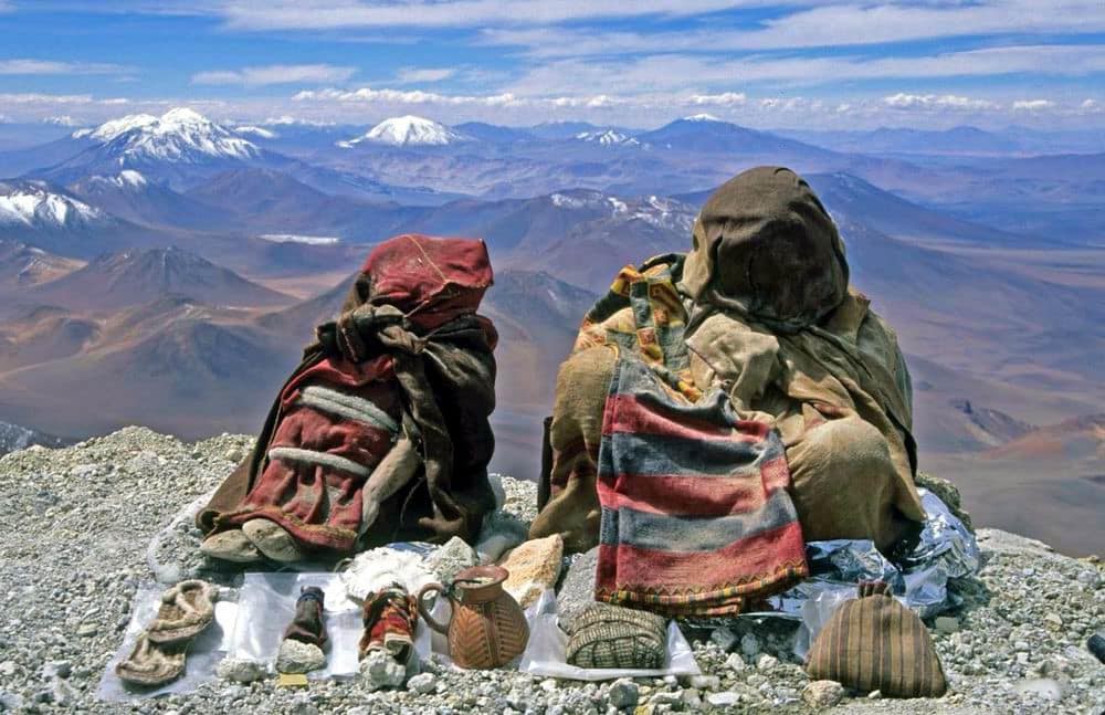 a 100-meter re-ascent from the col connecting it to the main summit. El Sarcófago is a curious elevated scoria formation that creates a break in the slope and raises a point (approx. 6,575 m) on the SE slope, named Lullaillabur (or Lincancaur) by its first ascensionists. This name led Argentina's IGN to include, on sheet 1:500,000 Paso Socompa (1954), a mysterious peak called Lincancaur slightly southeast of the great Llullaillaco. Extensive lava flows descend to the E, N and S. On the rest of the mountain, elevated scoria ridges alternate with depressions filled with loose scree. On the South face, since it receives fewer hours of sunlight than the other slopes, permanent snowfields are more extensive. The summit area is made up of a huge pile of large volcanic rocks, arranged in towers, the tallest of which drops directly to the N toward the flat ridge that holds the Inca shrine. In a crevice in the highest rock on the mountain there's a large log hidden away, which in Inca times may have stood upright on top of it. All heights given correspond to Chile's IGM, which matches the figures provided by SRTM and Argentina's IGN (at the points it marks).
6 - Huascarán - 6746 masl 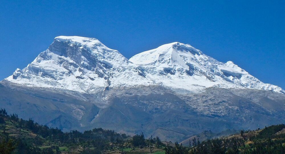
- Location: Cordillera Blanca, Peru
- Town and main access: Huaraz - Caraz.
- Best ascent season: June to August
- Summit GPS: 9°07´17¨ S - 77° 36´ 15¨W
It's the highest tropical mountain in the world, and the one with the most semi-technical glacier travel among the Americas' top 10 highest peaks. It's also the only one of the 10 that doesn't touch Argentine territory. It's visible from much of the Peruvian valleys of Huaraz and Caraz, with striking views that contrast sharply with the towns and forests of the Cordillera Blanca.
Topographic Description: Huascarán stands out within the striking setting of the Cordillera Blanca for its distinctive shape, more imposing than elegant, made up of a vast granite base topped by its two enormous ice-covered summits. It rises directly above the Callejón de Huaylas, to the southwest of the massif, and the Llanganuco ravine to the northwest and the Ulta ravine to the southeast. To the northeast, a saddle nearly 1,000 m deep separates it from Nevado Chopicalqui, considered part of the massif by several authors. Its two summits, the South or Main one (6,746 m) and the North (6,655 m), are separated by a col at 6,010 m, which, as with Tres Cruces, would grant each one independent status if we apply the +400 re-ascent criterion unanimously accepted for the Andes. Despite this, it's generally still treated as a single massif. This mountain has virtually no secondary summits, so the massif essentially coincides with the Main Body. The only exception is the SW peak of Huascarán Sur (6,410 m). The peaks Delgado Ubeda (5,600 m) and Elola (5,666 m), named by the 1961 Spanish Expedition, are both located on the Huascarán–Chopicalqui ridge (6,345 m). There's also a peak noted at 6,040 m, which is really nothing more than a shoulder on the SW ridge. All heights given correspond to Peru's IGN (charts updated in 1998).
5 - Tres Cruces - 6749 masl 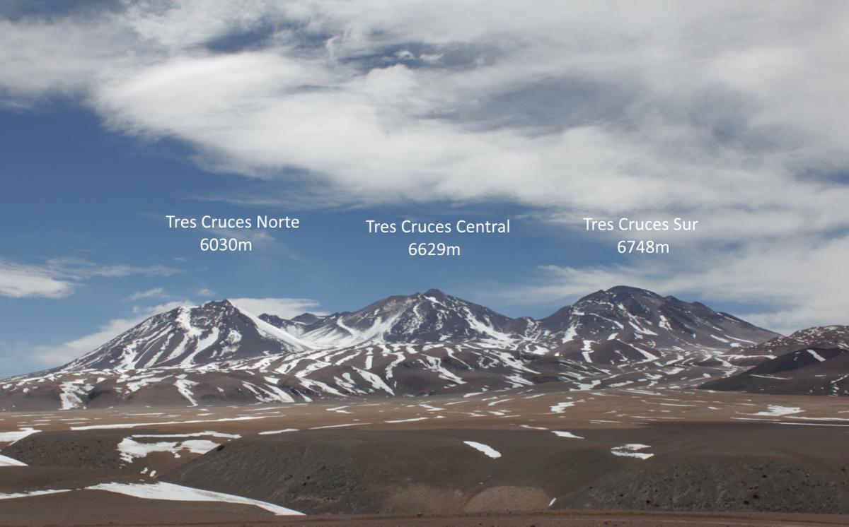
- Location: Catamarca (Argentina) and Atacama (Chile)
- Town and main access: Fiambalá, Route 60, Paso San Francisco.
- Best ascent season: October to March
- Summit GPS: 27°05´55¨ S - 68° 46´ 41¨W
Tres Cruces is another of the giant volcanoes clustered geographically in high Catamarca, on the border with Chile, that has a more heavily used normal route, given the complicated vehicle approach from the Argentine side. Like Huascarán, it has another summit that, based on the col-depth parameters set for the Andes, could be considered another separate +6500er (some projects already treat it as such).
Topographic Description: Tres Cruces has an unmistakable silhouette. From the E and W it stands out for its elongated profile with three peaks. Its main body is defined by its two gigantic summits: the Main or South Summit (6,749 m) and the Central Summit (6,629 m), separated by a col that barely reaches 6,000 m. As mentioned earlier, based on the +400 re-ascent criterion accepted for identifying independent neighboring peaks in the Andes, there would be two independent summits within this range. North of the Central summit lies Pico Polonia (6,320 m), and to the NW rises the striking Pico Norte or Cenizo (6,030 m), forming a broad amphitheater on its west face. Punta Chilena (6,452 m), for its part, extends westward as a shoulder off the Main summit. Seen from both the W and the E, Tres Cruces appears to be a mountain with three clearly distinguishable peaks. Curiously, though, they aren't the same three in each case. From the west you see Punta Polonia and the Central and Main summits, while from the east you see Pico Norte, the Central summit and Punta Chilena, behind which the upper end of the Main summit peeks out. All heights given correspond to Argentina's IGN, matching those provided by SRTM and essentially matching Chile's IGN.
4 - Bonete - 6759 masl 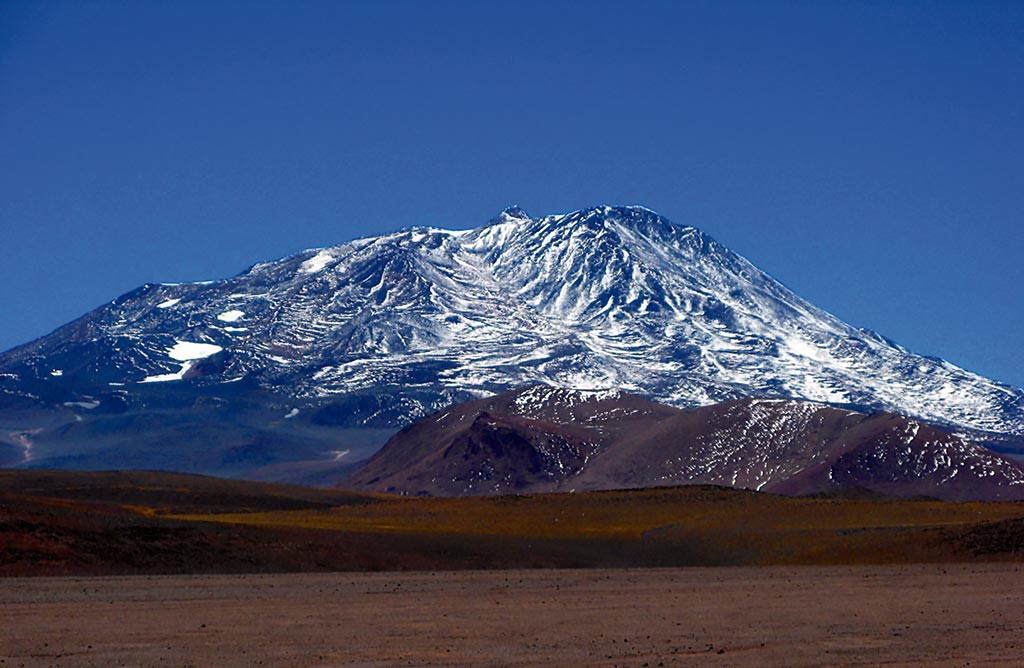
- Location: La Rioja (Argentina)
- Town and main access: Vinchina, Laguna Brava, Refugio Veladero.
- Best ascent season: October to March
- Summit GPS: 28°01´08¨ S - 68° 45´ 19¨W
Bonete is one of the least-visited +6500ers due to its complicated approach. It's also called Bonete Chico due to a mapping error in the original cartography, which mistakenly assigned the name Bonete Grande to another mountain that, based on that location, is now known to be under 6000 m. It has a conical summit barely visible from a distance. It ranks third among the world's highest volcanoes, a spot on the podium.
Topographic Description: Bonete has a substantial structure resting on a raised base that extends a long way to the N, presenting numerous satellite peaks. Its main body resembles a crown, with four secondary summits enclosing a plateau above which rises the conical Main Summit (6,759 m), which gives the mountain its name. Their relative position to this main summit gives the other peaks the names North (6,725 m), South (approx. 6,675 m), West (6,501 m) and East (6,325 m). The first two, being taller, give the summit plateau an oval shape, split in two by the Main Summit. North of the main body extends the Cordón de los Pioneros, where 5 peaks over 6,000 meters stand out. All heights given correspond to Argentina's IGN, matching those provided by SRTM.
3 - Pissis - 6795 masl 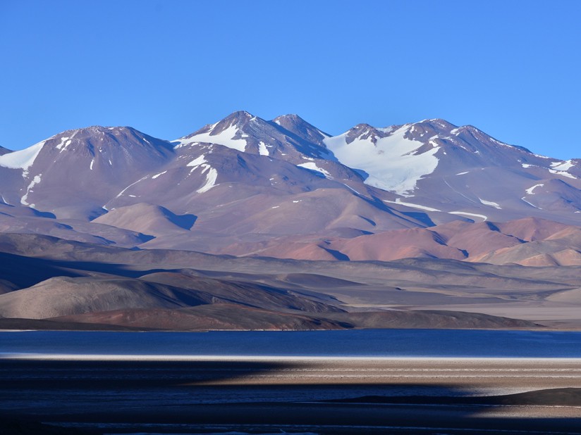
- Location: Catamarca-La Rioja (Argentina)
- Town and main access: Fiambalá, Route 60
- Best ascent season: October to March
- Summit GPS: 27°45´17¨ S - 68° 47´ 56¨W
- Organized expedition program: Click
Pissis is one of the most interesting of these giant mountains and, until recently, was considered the second highest. Its remote location deep in the Puna and its imposing profile have turned it into an icon of high-altitude mountaineering, visited by climbers from all over the world. It has 5 summits and is the world's second-highest volcano. It's also the highest point in La Rioja Province.
Topographic Description: One of the vastest mountains in the Andes, the Pissis massif runs NW to SE across the 22 km separating its two most distant high points. Its main body occupies the center, with more than 2 km separating the Main Summit from the second-highest, which is only 4 m lower. On its main body, five summits are visible from the Laguna Verde area (forming what's known as the North Profile). From left to right (SE to NW) these are Ejército Argentino (6,788 m), UPAME (the massif's second highest at 6,791 m), Cardenal Samoré (6,690 m), Principal or CAM (6,795 m), and Gendarmería Nacional (6,690 m). To the SW of the Main summit rises (hidden from Laguna Verde) the Pissis IV summit (6,740 m), considered the massif's sixth summit. Pissis is the most heavily glaciated mountain in the Puna. The Glaciar de los Argentinos occupies the center of the NE face, showing a field of crevasses in its central section. On the opposite face lies the Glaciar de los Italianos. The immense Glaciar Oeste, the largest in the region, covers nearly the entire plateau that stretches between 5,700 m and 6,000 m, between the main body and the Pillán, Tres Picos and Altar del Pissis peaks. All heights given correspond to SRTM topographic data.
2 - Ojos del Salado - 6893 masl 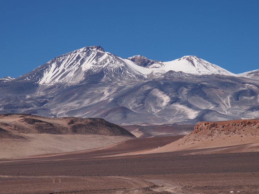
- Location: Catamarca (Argentina) and Atacama (Chile)
- Town and main access: Fiambalá, Route 60, Paso San Francisco.
- Best ascent season: October to March
- Summit GPS: 27°06´35¨ S - 68° 32´ 31¨W
Ojos del Salado is Chile's highest point, the world's highest volcano, the highest point in Catamarca Province, and the second-highest mountain in the Americas, just 70 meters shy of Aconcagua. From Chile, high-altitude refuges are reached via a well-marked trail along what's considered the Normal Route, but from Argentina the approach is grueling and very long.
Topographic Description: The Ojos del Salado massif is formed by a vast set of craters and volcanic peaks, above which rises a tall cone that makes up the Main Summit. Its main body is made up of three summits aligned E to W, respectively called Principal (6,893 m), Central (6,752 m) and Oeste (6,721 m). The first is also called Bífida (Split) because it culminates in two rocky towers of equal height, separated by about 50 m across a 30 m deep gap. The Eastern tower is the culmination of the large slopes that make up the volcanic cone, and on it sits a small metal pyramid marker. The Western one is an isolated, flat-topped spire that rises between the mountain's two most prominent craters, topped with a stone cairn and a metal pole. All heights given correspond to Chile's IGM.
1- Aconcagua - 6962 masl 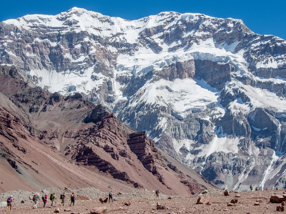
- Location: Mendoza (Argentina)
- Town and main access: Mendoza, Puente del Inca.
- Best ascent season: December to February
- Summit GPS: 33°39´12¨ S - 70° 00´ 44¨W
- Organized expedition program: Click
The Colossus of the Americas, or the Stone Sentinel, is visited year after year by people from all over the world, on expeditions mostly organized by local companies. It lies within Aconcagua Provincial Park and has two base camps set up and operating throughout the season. The Normal Route ascends along the northwest slope, where the highest-altitude mountain refuges in the world have been built. The south face, with nearly 3000 m of sheer vertical drop, is one of the most coveted challenges for climbers looking to push their limits.
Topographic Description: Aconcagua is a colossal truncated pyramid with stepped, generally steep walls, surrounded by a wide array of satellite peaks. The mountain's main body has two summits, the North or Main one (6,962 m) and the South one (6,930 m), which is actually located to the SW and connects to the main summit via the Filo del Guanaco ridge. The Aconcagua massif is one of the largest in the Andes. Applying the 400-meter prominence criterion, four low saddles separate it from the peaks Cúpula de Güssfeldt (to the N), Ameghino (to the NE), Rico (to the SE) and Mirador (to the S). To the west, however, a vast set of peaks extends, connected by consistently high ridges, starting with El Cuerno (5,462 m) and Horcones (5,395 m). To the SW of the latter lies Pan de Azúcar (5,100 m), and to the north the massif continues in a series of lower but sustained elevations, among which Alma Blanca (5,152 m) stands out. South of Horcones lie, in a row, Catedral (5,335 m) and Bonete (5,004 m), beyond which the low Portezuelo Nazar separates the massif from Cerro Dedos, from which a long ridge extends, culminating to the south at Cerro Tolosa. Finally, the peaks Fitz Gerald (5,357 m), Ibáñez (approx. 5,300 m) and Pirámide or Piramidal (approx. 5,900 m) are located respectively to the N, E and S of the main body. To the NW, near Nido de Cóndores camp, rises the point known as Cerro Manso (5,510 m). All heights correspond to Argentina's IGN.
Additional bibliography: +6500, una forma de dimensionar los Andes. Bracali, Dario and Almaraz, Guillermo