June 4, 2020 · Leandro Alemán Scheurle
Exploration is ideally understood as the art of absolute revelation. Discovering and traveling through the wild corners of a lost river. Discovering and traveling a new route to the summit of a mountain. But also discovering and traveling through the geography of our inner selves, the feeling expressed in a landscape and in every new footprint immortalized along the way.
The so-called Ice Field Circuit is one of the most sought-after crossings by adventure travelers from around the world. El Chaltén, in the province of Santa Cruz, is the starting town and trailhead for this and many other routes that move trekkers and explorers alike. Although this route can be done from south to north, entering the ice first via Paso del Viento, it's most common to enter from the north, via Paso Marconi. The trail begins at the bridge over the Río Eléctrico and runs outside the boundaries of Los Glaciares National Park. The path continues west, heading into a well-defined valley that gradually climbs toward the ice and snow of the Marconi Glacier. The crossing of the Polone River is a notable landmark on the route. Fording the fast-flowing mountain rivers can turn into quite a challenge, whether for an expedition or for a simple short hike. Finally, the traditional first day ends at the campsite beside Lago Eléctrico, known as La Playita. Backpacks drop to the ground and tents begin to go up once the guides have assessed the terrain. The sea of clouds bursts into the melancholy of dusk and covers the last patches of the sky's longed-for blue.
Lucas, Milena and Julián arch their necks back and, gazing at the endless sea of clouds, grumble and curse this natural phenomenon. I exist, therefore I think.
Success in the mountain world, as we well know, is measured in excessive and blunt terms. Whether or not you reach the summit, whether or not you complete a long crossing, whether or not you finish the committed length of a climbing route. To be or not to be seems to live forever within these rankings. In the case of an outing like this one, of a purely and exclusively experiential nature, success comes from correctly applying movement techniques on complex terrain, from concentration, but also from not wasting a single minute of each natural image — the very thing that can grant us one of the most sought-after feelings of happiness. With low visibility, travel through these latitudes must be paired with proper navigation tools, unless you want to end up dancing with unfavorable situations. Topographic maps, a compass and a GPS are the order of the day. And at that moment you find yourself transported to the insane vision of those explorers and rule-breakers of the early 20th century, when they were able to venture into such settings with such rudimentary equipment. What legends!
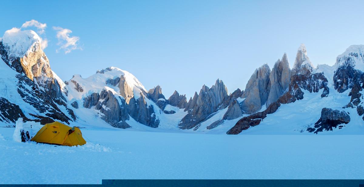
The heading is south, very south. To the left, the west face of the Cordón Marconi can be seen. To the right, and far in the distance, the immeasurable view of the Cordón Mariano Moreno and the Witte and Viedma Nunataks. The adventure shines in its fullest splendor. After 10 uninterrupted hours, and with sunset imminent, camp is set up a few hours before the well-known Circo de los Altares. Shovel in hand, platforms and walls to contain and shield against the wind are gradually built. The tents are like blazing stars in the most dreamed-of space. They are flashes of color on the frozen, motionless and immeasurable mirror. The night passes. The unyielding mass of vertical granite suddenly appears on the immediate horizon: Cerro Torre, nothing more and nothing less.
Romina, Elián and Darío rotate their necks and, exhausted, take in the endless path still ahead. I exist, therefore I think.
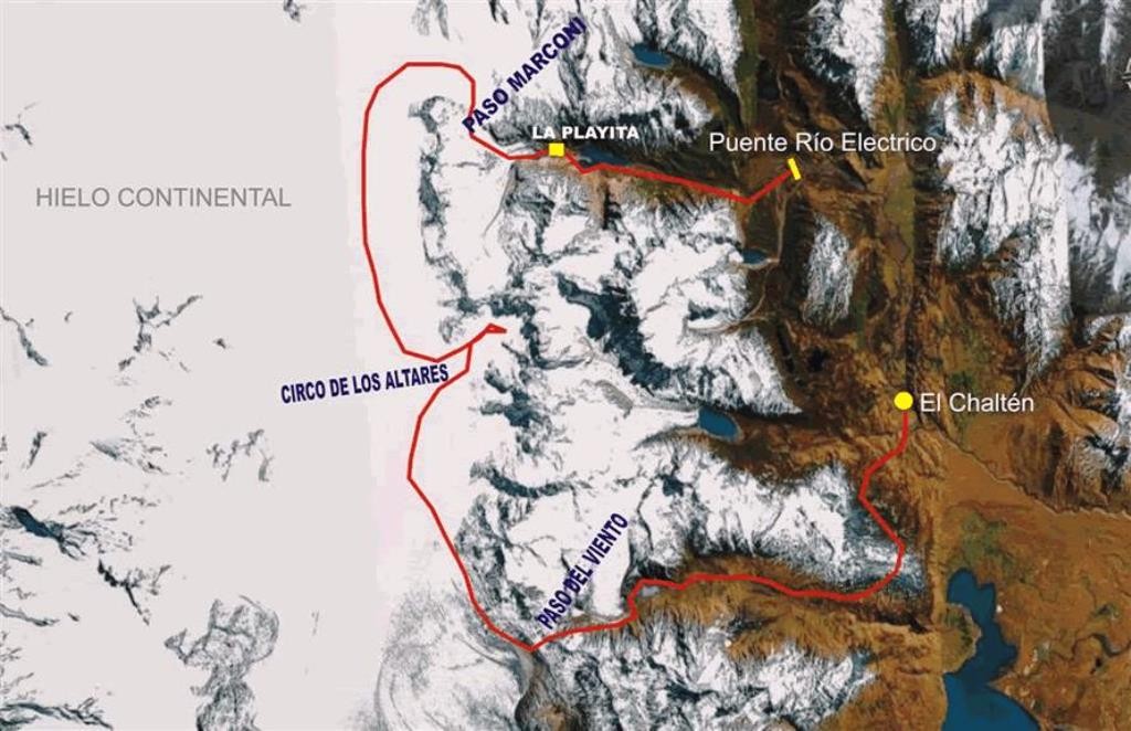
Mentally replaying everything that happened always plays its decisive role in building up unforgettable experiences. The final stretch from Toro to El Chaltén was, in this case, the ideal path to put that into practice. Exploration and success had joined hands in exactly the ideal terms that had been sought. An unmatched dose of untouched land had sunk deep into these souls; wild and exultant souls; hopeful and eager for an intense and deeply passionate experience.
The stars in the sky are now dreamed-of blazing flashes reflected in the frozen mirror. Verónica, Francisco and Agustín kneel, still roped together, and share a moment of silence that invites reflection. I exist, therefore I think. I exist because I can recognize the passion and the indescribable feeling that overtakes us every time we see ourselves reflected in sensations and experiences so enriching and enduring that they nourish us from head to toe, as physical and spiritual beings. I exist because I believe in, and witness firsthand, the extraordinary beauty of our world, both as matter and as an intangible body traveling toward the beyond. I exist because I am endlessly grateful for the chance nature gives us to act within it and to keep cultivating our soul day after day. And then that same phrase brings to mind that immortal definition by René Descartes, taking Doubt to its ultimate consequences: I think, therefore I exist (Cogito Ergo Sum). And I flip it around without shame: I think it after existing, because after existing amid so much unforgettable natural dialogue, life never strays from the path.
To examine this border issue in detail, it's important to clarify that the correct name is Southern Patagonian Ice Field. The expression "Continental Ice" was popularized by the media and is better known to the general public. The difference is that an ice field has a maximum surface area of 50,000 km2, an elongated shape, and is subject to geological controls that govern the movement of ice masses. An ice cap, on the other hand, has a larger surface area and flows independently of the underlying terrain.
There is an ongoing dispute with Chile over the Continental Ice, extending between Mount Fitz Roy and Cerro Daudet. This concerns the Southern Patagonian Ice Field, whose boundary was agreed upon in the late 19th century and confirmed by the English arbitration award of 1902, but had never been physically demarcated. This led Chile to put forward new claims, giving rise to the "polygonal line" proposal in the 1991 agreements.